Isaac Corley
Senior Machine Learning Scientist
Zeitview
Hello! I'm Isaac, a Machine Learning Scientist/Engineer at Zeitview with a Ph.D. in Electrical Engineering from the University of Texas at San Antonio (UTSA) advised by Paul Rad. I currently train and deploy computer vision, vision-language, and 3D reconstruction models at scale for mapping and inspecting renewable energy assets (e.g. solar farms, commercial buildings, wind turbines) using a mixture of RGB & thermal-infrared aerial and satellite imagery.I'm passionate about machine learning and computer vision particularly applied to the geospatial and remote sensing imagery domain. I also regularly contribute & maintain popular open-source projects like TorchGeo and TorchSeg.In a past life, I was involved in developing machine learning solutions for the signal processing, cybersecurity, and biomedical sensor fields as well as updating the embedded software for the U.S. Air Force's A-10 Warthog.I'm currently available for consultations. If you're interested in collaborating please reach out!
Projects
TorchSeg
An up-to-date fork of the segmentation-models.pytorch (smp) library with added features like complete timm ViT backbone support, and more thorough testing/linting/code coverage.
PyTorch Enhance
A PyTorch domain library of implementations of deep learning-based image super-resolution methods.
Selected Publications
WACV CV4EO 2024
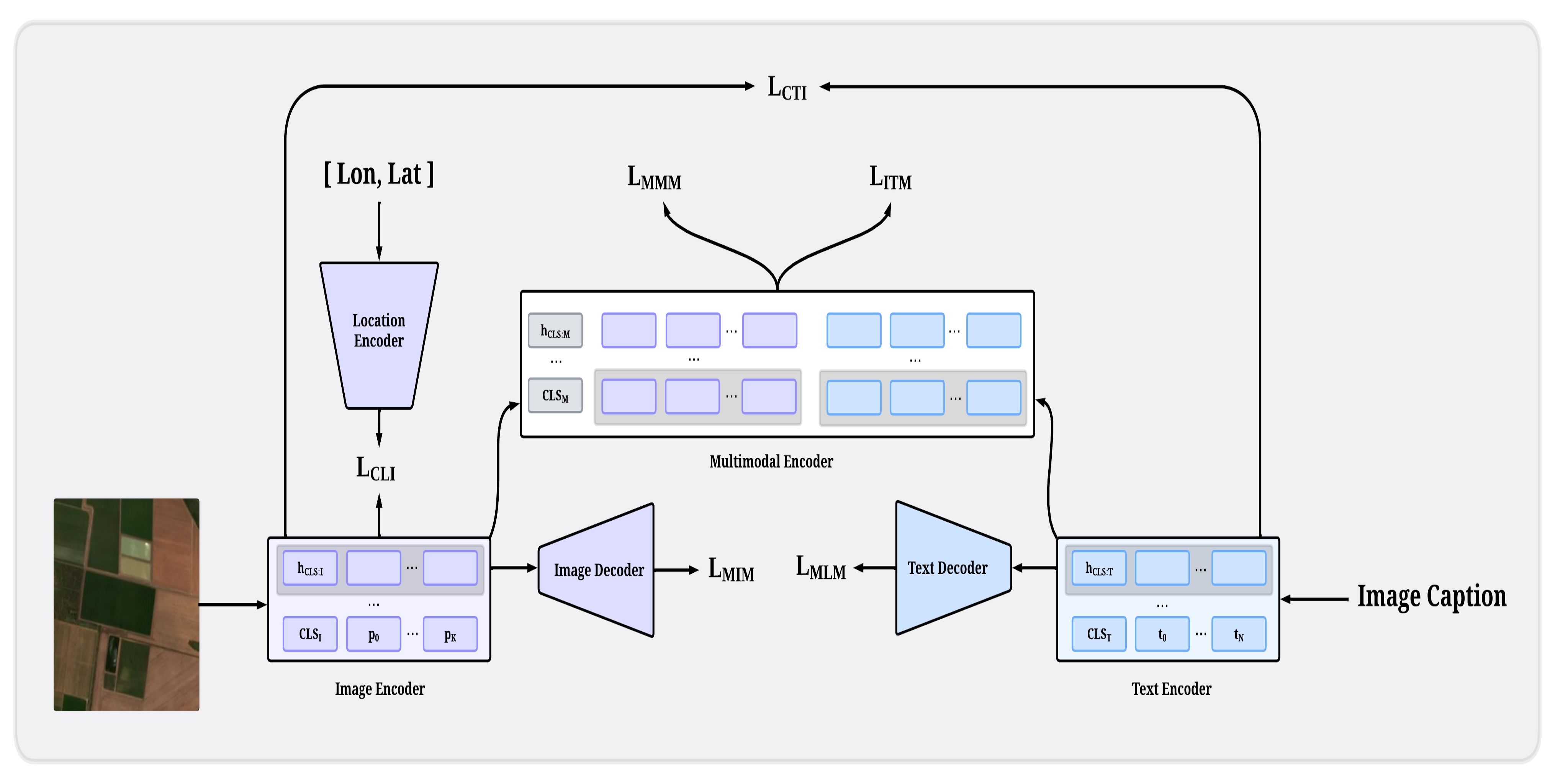
FLAVARS: A Multimodal Foundational Language and Vision Alignment Model for Remote Sensing
Isaac Corley, Simone Fobi Nsutezo, Anthony Ortiz, Caleb Robinson, Rahul Dodhia, Juan M. Lavista Ferres, Peyman Najafirad
We find that pretraining using CLIP+MAE+MLM+SatCLIP objectivers provides better balance for dense vision tasks over pure CLIP and FLAVA pretraining.
IROS 2024
🏆 Best Application Paper Runner-Up
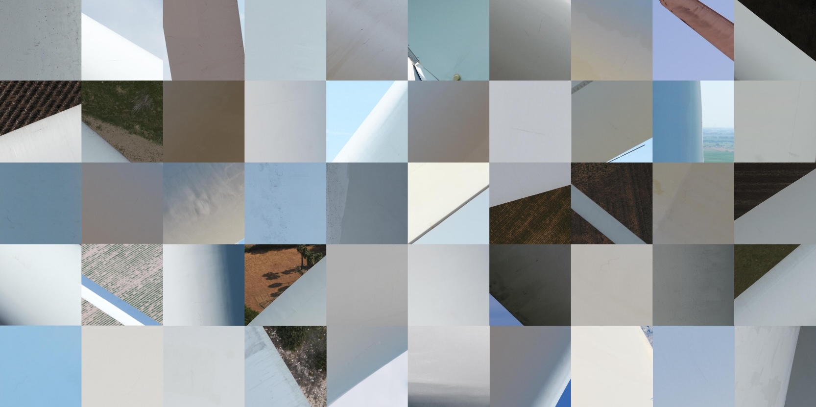
Barely-Visible Surface Crack Detection for Wind Turbine Sustainability
Sourav Agrawal, Isaac Corley, Conor Wallace, Clovis Vaughn, Jonathan Lwowski
We present a novel dataset and pipeline for detecting barely-visible surface cracks on wind turbine blades.
IGARSS 2024
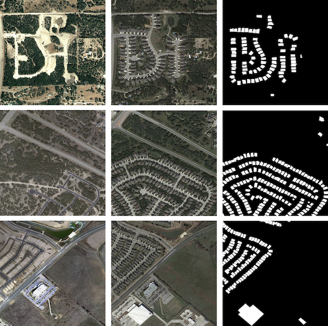
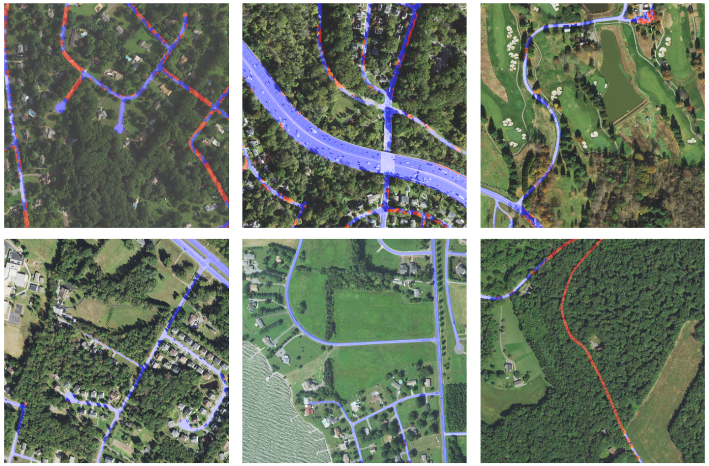
Seeing the roads through the trees: A benchmark for modeling spatial dependencies with aerial imagery
Caleb Robinson, Isaac Corley, Anthony Ortiz, Rahul Dodhia, Juan M. Lavista Ferres, Peyman Najafirad
We introduce a novel dataset for evaluating a model's ability to use long-range spatial context by performing road extraction in aerial imagery with high amounts of occlusion by tree canopy.
CVPR PBVS 2024
Revisiting Pre-trained Remote Sensing Model Benchmarks: Resizing and Normalization Matters
Isaac Corley, Caleb Robinson, Rahul Dodhia, Juan M. Lavista Ferres, Peyman Najafirad
We perform a comprehensive benchmark of geospatial foundation models and find that they are highly sensitive to pretrained image size and normalization.
NeurIPS 2023
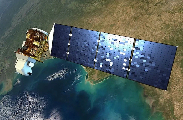
SSL4EO-L: Datasets and Foundation Models for Landsat Imagery
Adam J. Stewart, Nils Lehmann, Isaac A. Corley, Yi Wang, Yi-Chia Chang, Nassim Ait Ali Braham, Shradha Sehgal, Caleb Robinson, Arindam Banerjee
We introduce SSL4EO-L, the first ever dataset designed for self-supervised learning for Earth Observation for the Landsat family of satellites.
ACM SIGSPATIAL 2022
🏆 Best Paper Runner-Up
TorchGeo: Deep Learning with Geospatial Data
Adam J. Stewart, Caleb Robinson, Isaac A. Corley, Anthony Ortiz, Juan M. Lavista Ferres, Arindam Banerjee
We introduce TorchGeo, a Python library for integrating geospatial data into the PyTorch deep learning ecosystem.
Experience
Senior Machine Learning Scientist — Zeitview (formerly DroneBase)
Research, develop, train, and deployed computer vision, vision-language models (VLM), and 3D Reconstruction methods at scale for enhancing renewable energy inspections and analytics, including solar farms, wind turbines, commercial and residential rooftops, transmission and distribution stations, and telecom towers.
Ph.D. Research Intern — Microsoft Research
Advisor: Simone Fobi Nsutezo & Anthony Ortiz
Researched multimodal pretraining methods for large-scale geospatial vision-language datasets.
Senior Machine Learning Engineer — Spruce
Applied state-of-the-art Optical Character Recognition (OCR) and Text Summarization methods to parse real estate and financial documents.
Senior Machine Learning Engineer — BlackSky
Developed and deployed models to drive the Spectra AI platform's satellite image analytics as well as served as the PI on the IARPA SMART program.
Senior Data Scientist — HouseCanary
Developed and deployed computer vision models for extracting insights and features from real estate property images for improving HouseCanary's Automated Valuation Model (AVM) and property recommender system utilized by real estate investors.
Senior Data Scientist — Booz Allen Hamilton
Researched and developed prototypes for deep learning-based image steganography detection and removal as well as adversarial domain generation detection.
Research Engineer — Southwest Research Institute (SwRI)
Advisor: Kenneth Holladay
Developed and deployed software updates to the A-10 Warthog aircraft as well as researched machine learning methods for detecting engine stalls and exploiting the MIL-STD-1553 communications bus.
Research Intern — Oak Ridge National Laboratory (ORNL)
Advisor: Paul Ewing
Recorded and annotated a dataset of seismic signals of human and vehicle activity and trained machine learning methods to detect this activity.
Education
University of Texas at San Antonio
Ph.D. in Electrical Engineering
Advisor: Paul Rad
University of Texas at San Antonio
M.S. in Electrical Engineering
Advisor: Yufei Huang
Texas A&M University - Kingsville
B.S. in Electrical Engineering, Minor in Mathematics